Time lapse is a method of making video by connecting pictures taken one frame at a time at regular intervals.
A Mountain to Climb in Worship
Worship of Mt. Fuji in Shizuoka is largely influenced by the fact that the major Tokaido Highway crosses the prefecture from east to west. There is also relation to marine traffic because it faces ....
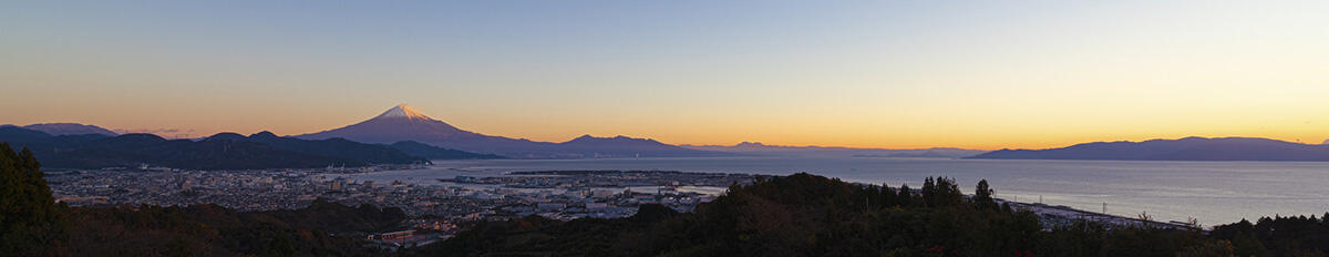
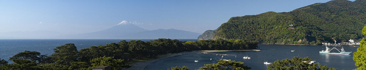
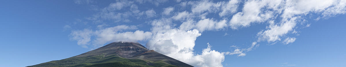
Mt. Fuji from the sea
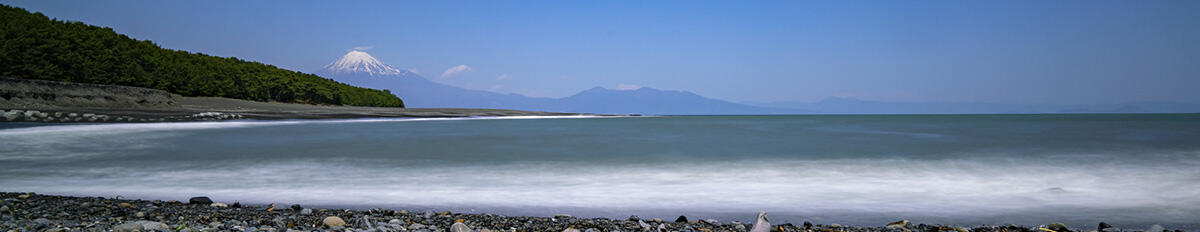
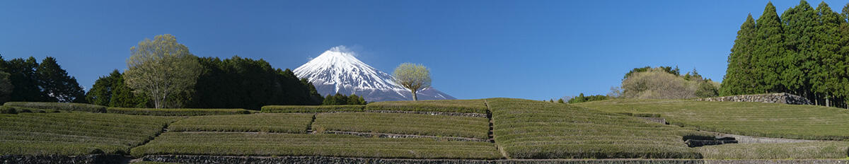
The foot of Mt. Fuji sweeps out across the land as it rises out of the ocean in all its glory. Back in the days when people climbed Mt. Fuji as an object of mountain worship, they saw the mountain from far away, and were no doubt captivated by its graceful beauty with each step they took toward it. There are numerous spots for viewing Mt. Fuji, including Nihondaira, Miho no Matsubara, and Heda in West Izu offering views across Suruga Bay, Chikai-no-Oka in Oyama Town to the east, Obuchi Sasaba to the south with its vividly-colored tea plantations, and Asagiri Kogen to the west offering views across the valley of Osawa collapse. The mountain offers us views that change with the seasons and time of day.
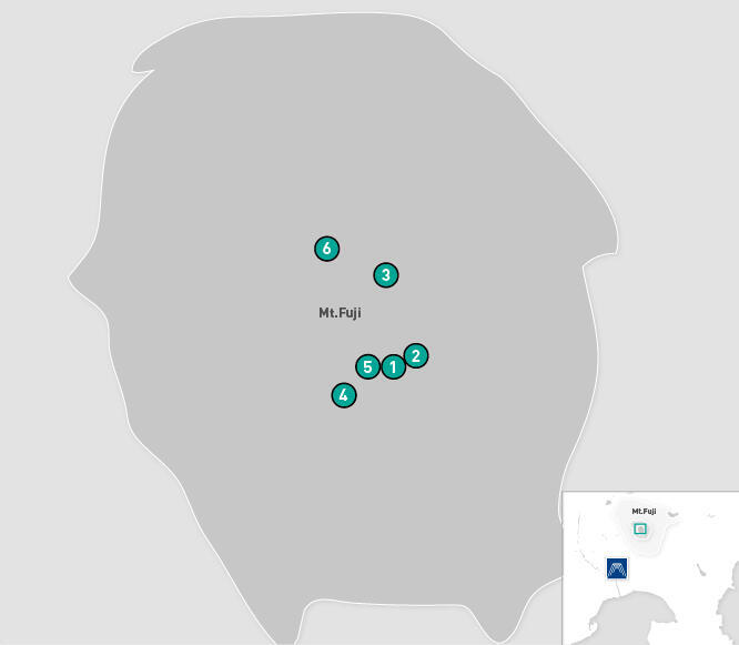
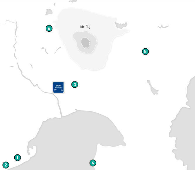
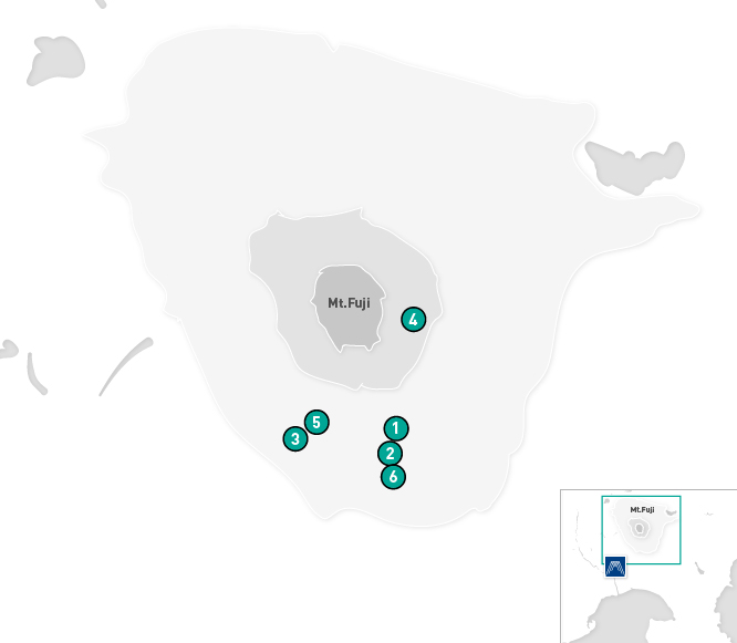
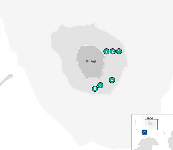
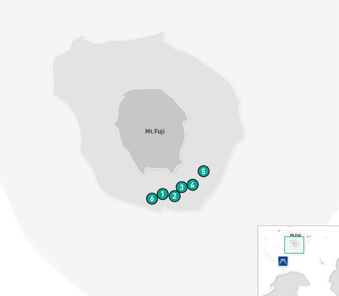
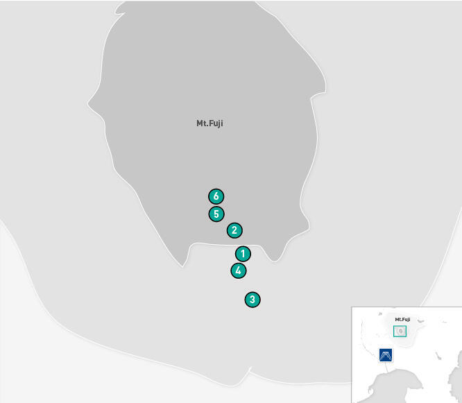
Map of videoed area
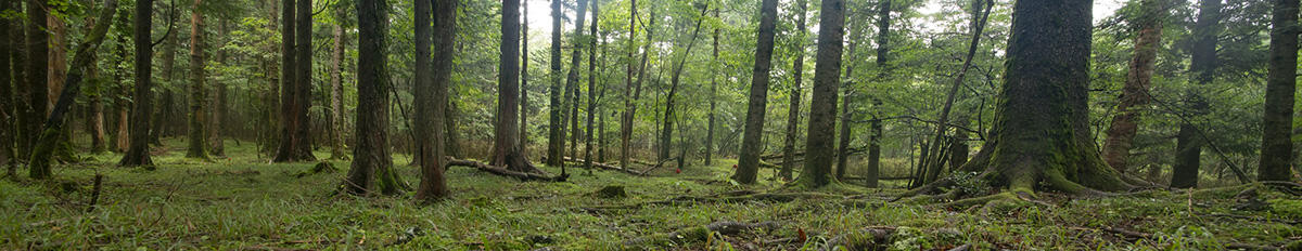
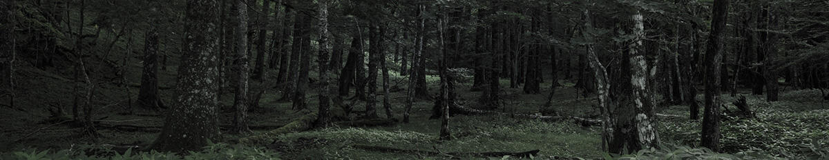
From level ground to the 5th Station
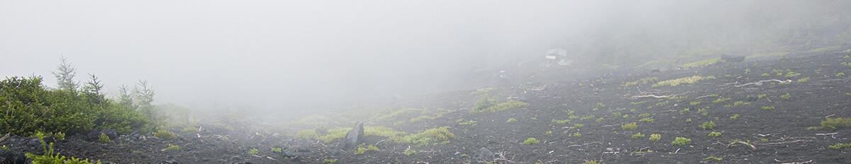
People who gather at the foot of Mt. Fuji visit Sengen-jinja Shrine at the start of the mountain trail. They then walk through the forest that extends across the foot of the mountain. Mt. Fuji boasts the most diverse vertical distribution of plants in the Japanese archipelago, with an evergreen forest of chinquapin and oak trees at its base, and a summer green forest of beech, water oak and white birch trees up to 1500 m. Conifers, including Veitch's silver fir and larch trees begin to appear with rising altitude in the subalpine zone. It also rains frequently at the foot of the mountain, giving birth to lush forests that retain moisture, and the floor of the forest along the trail is overgrown with mosses.
Map of videoed area
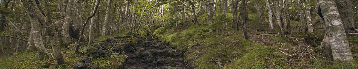
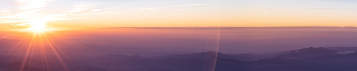
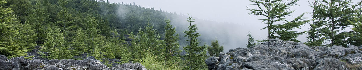
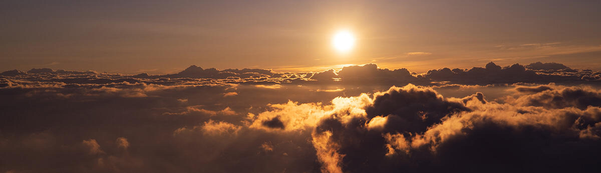
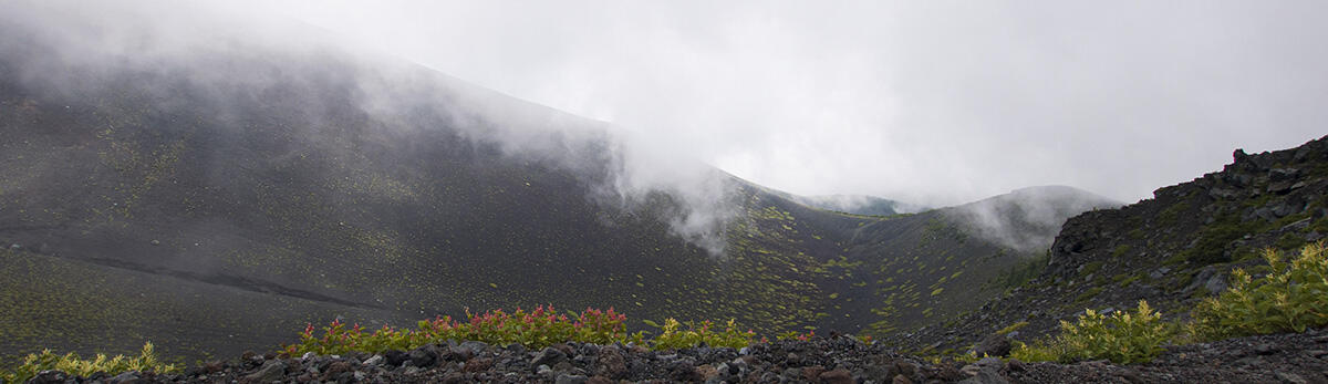
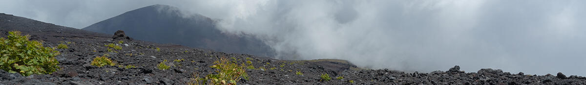
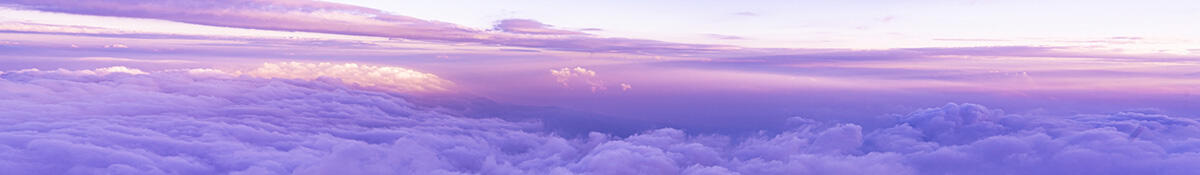
From the 5th station to the forest line (1)
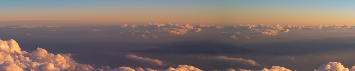
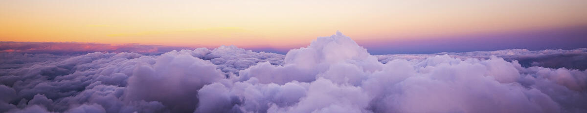
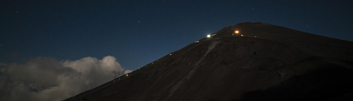
"Rise above the clouds" and peer out across the sea of clouds and you will understand the meaning behind Sazanami Iwaya's song, Fuji-no Yama, in which he wrote "Mt. Fuji is the greatest mountain in Japan." As you climb higher, even the conifer trees become sparse, and most of the trees become stunted shrubs of larch. "Ondate", a pioneer plant, can be seen growing in wind-exposed or desolate places where other plants have difficulty taking root.
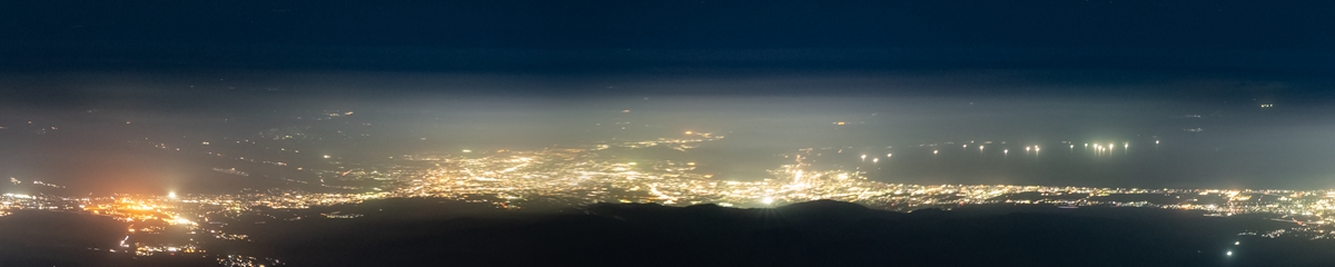
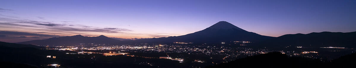
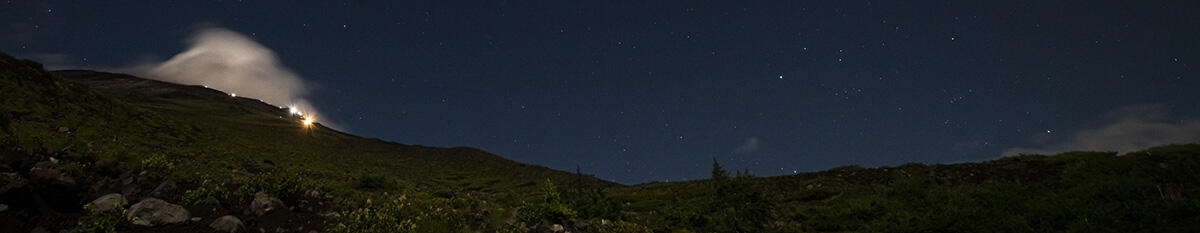
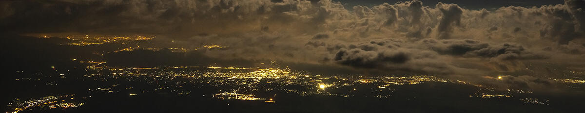
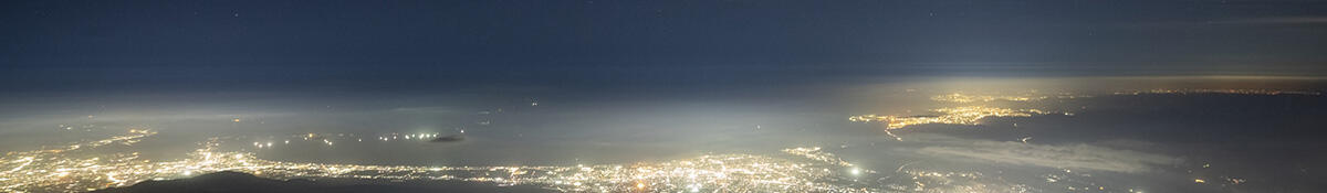
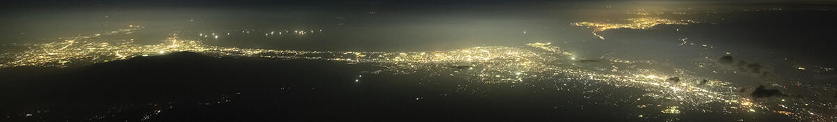
During the season when Mt. Fuji is opened to climbers, you can see strings of light at night as people head toward the summit, while looking back offers views of lights from towns, cars and factories at the foot of the mountain.
Map of videoed area
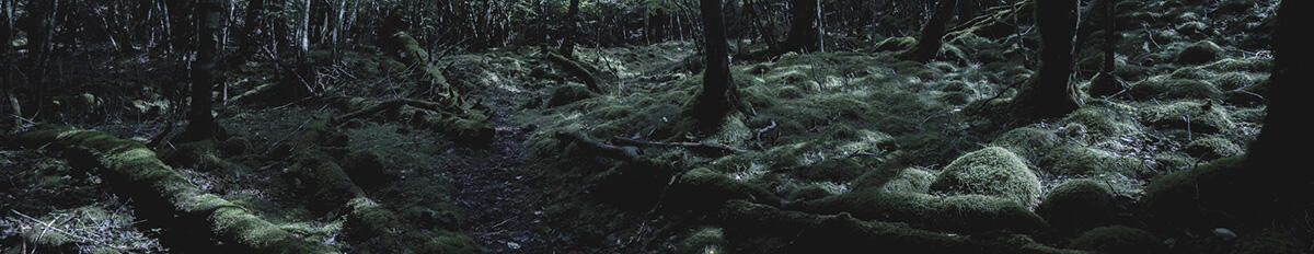
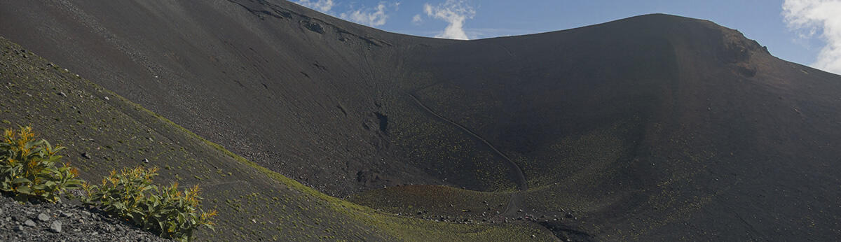
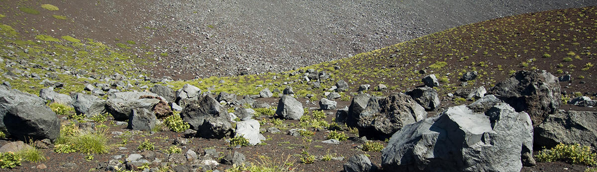
From the 5th station to the forest line (2)
On the southeastern slopes of Mt Fuji, at altitudes of around 2,100 to 3,150 m, there are three craters, which were formed during the Hoei eruption of the Edo period in 1707. From the summit, these craters are called Crater No. 1, Crater No. 2 and Crater No. 3. The biggest Crater No. 1 has a diameter of around 1.3 km, and it is bigger than the crater at the summit. An eruption of the craters spewed out pumice and scoria for around half a month, and volcanic ash rained on Edo and the Kanto region far away. The Suyama-guchi trail passed below these craters, but the eruption led to the creation of a new trail on the eastern side to avoid the craters.
Map of videoed area

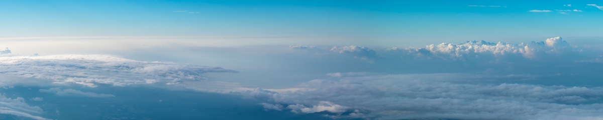
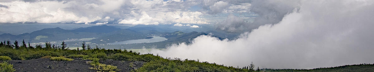
From the forest line to the summit
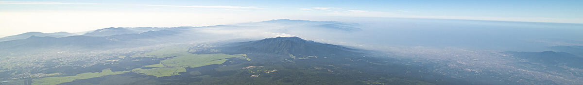
Rising above the tree line, there is nothing to obstruct the view on a clear day, offering people views of the trail leading up to the summit. Approaching the summit offers climbers views of Mt. Hakone and Mt. Ashitaka below them, as well as extensive views of mountains further away, Suruga Bay and even the metropolitan area. The ground is covered in lava and scoria, with almost no vegetation growing on them. Most of Mt Fuji has been newly formed in eruptions over the past 10,000 years, and compared to the high mountains of the Chubu region with their long history, Mt. Fuji has yet to be inhabited by many plants and animals.
Map of videoed area

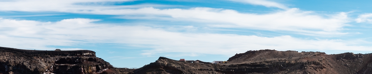
The view from the summit
The summit of Mt. Fuji enshrines "nine honored buddhas on the eight-petaled lotus" for which it is a destination for worship, and the deity is enshrined at the bottom of the crater. It is the place of origin for the faith visited by many worshippers even today who gather to offer prayers to the rising sun. The summit was formed around 2,300 years ago when the crater erupted, and the magma that spewed out turned into volcanic bombs and scoria, forming a thick layer around the brim of the crater, and the inner wall shows signs of a lava lake. The Ohachi-Meguri Trail (crater loop) takes worshippers around the summit in a loop pilgrimage that has its roots in the likening of the crater rim to a lotus flower with eight petals, with geothermal energy and fumaroles observed at Aramaki, Higashi Yasuno Kawara and other places until around the middle of the Showa period.
Map of videoed area